Six Alpine plateaus to explore through meadows, pastures, mountain huts and villages
A plateau is best understood by following a road connecting two mountain pastures, observing the end of a mown meadow, or waiting for the train that connects the villages. These are more precise clues than the bells and huts photographed from afar. The six itineraries in this guide offer insights into six different ways of using the mountain : mowing, grazing, water management, seasonal settlements, and regulated connections and access.
The suggested walks range from forty minutes to about three hours and start from identifiable points. Some cross active agricultural land, others follow roads also used by workers. Therefore, it's a good idea to know the route before setting out and leave meadows, gates, and service roads clear. The goal is to enjoy a beautiful walk while also understanding what you're seeing.
Alpe di Siusi: crossing meadows, streams and patches of woodland
page sections
On the Alpe di Siusi , the Hans and Paula Steger trail starts in Compaccio, near the church of San Francesco, and ends in Saltria. The 8,7-kilometer hike takes about two hours , with a 301-meter ascent and a 475-meter descent. Trails 30 and 12 connect Compaccio, the Steger-Dellai trail, an ancient mountain pasture trail through streams, forests, and meadows, and finally Saltria.
The variety of the layout helps distinguish different uses. A mown lawn often has a more uniform height and must remain free until cut; a pasture displays unevenly worn grass, fences, and animal passageways. These are signs to be observed from the trail, without automatically assigning the same function to every plot.
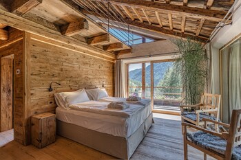
Discover the best offers to spend a summer holiday in the best alpine chalets and cabins in the Dolomites, the best structures immersed in the heart of the Dolomites with a typical alpine style
The trip is straightforward: for the return journey, the map indicates Almbus 11 from Saltria . The operating times and season should be checked before boarding. Access to the plateau is also regulated; the cable car and bus are not dependent on parking spaces and current restrictions. Compaccio, Saltria, and the return journey must be listed together on the itinerary.
Asiago Plateau: A mountain road leading to Mount Cimon
On the Asiago Plateau , the trail to Monte Longara begins from the Campomulo Refuge forecourt. The local hiking guide suggests a 7,8-kilometer hike, a 230-meter climb , and approximately two and a quarter hours. The dirt road climbs to the monument dedicated to John Paul II; from there, a detour leads to the Great War observatory on Monte Cimon. The trail then continues along the ridge toward Malga Longara and returns along the same route.
The hiking map indicates Malga Longara di dietro (behind) and Malga Busafonda-Campomulo (behind). The described route reaches Malga Longara in front: "davanti" (behind) and "di dietro" (behind) identify two distinct points, which should not be confused when reading the map. Dirt roads, buildings, and pastures form a network also used for moving between the mountain pastures.
The Monte Cimon viewpoint adds useful reading. From above, you can see the central basin, the Melette hills, and the distribution of woods and open spaces. Work vehicles may pass along the dirt road: walk on the safe edge, leave the path clear, and follow any temporary detours indicated on site.
Lessinia: Understanding Why Every Pond Matters
From the Camposilvano parking lot, near the Geopaleontological Museum, the Valle delle Sfingi loop passes through one of the most recognizable landscapes of the Lessinia region. It passes limestone formations, the Malga Buse di Sotto and Malga Buse di Sopra , the Croce dei Norderi, and the Rifugio Lausen, then returns via the Covolo di Camposilvano. The route is 8,4 kilometers long and takes about three hours , with 300 meters of elevation gain and easy-medium difficulty.
The limestone allows rain to seep rapidly, and the upper Lessinia has very little surface water. The highlands are a vast grazing area, managed primarily by cattle, but also by sheep, goats, and horses. Retaining surface water is therefore essential for mountain grazing : the waterproofed pools are livestock infrastructure, as well as small wetlands.
After the cattle have passed, a pond may have cloudy water and trampled banks , yet it continues to serve its intended purpose. It should be observed from the outside, without entering or allowing a dog to reach it. Near the herds, the Park requires a safe distance and requires dogs to be leashed. The route thus combines rock, water scarcity, and the presence of mountain pastures within a few kilometers of walking.
Prato Piazza: work at the edge of the 2,000-meter mark
At Prato Piazza, a short hike is enough to see how limited the usable space becomes at altitude. From the plateau parking lot, forest trail 37 reaches the Vallandro Refuge: 2,4 kilometers, a 60-meter climb, and about 40–60 minutes. The altitude remains around 2.000 meters, and the wide surface makes the hike accessible to many hikers.
At about two thousand meters above sea level , the trail reveals even grassy surfaces, areas marked by cattle traffic, larch trees, and scree slopes. Even, accessible terrain may allow mowing; steep or rocky sections are more suitable for grazing or the absence of agricultural use. These are clues, not definitive labels: exposure, soil, and local management are as important as the appearance of the meadow.
Road access and bus service are seasonal. The Prato Piazza website publishes current schedules and availability; it's best to check it the day before, rather than relying on schedules saved from a previous visit. At this altitude, even a short walk requires sun protection, water, and a layer for the wind.
Alpe Devero: exploring the mountain pastures as you move from one village to another
The most useful route for understanding Alpe Devero starts from the terminal car park, climbs to the small church, and crosses the plain towards Crampiolo. From there, it continues to Vallaro and Fontanelle, descends to Cantone, and completes the loop via Giavina, Alsone, and Pedemonte. The loop is 6,2 kilometers long and has 145 meters of climbing , on dirt tracks and wide trails classified as easy.
The ring's distinctive feature is the succession of settlements. Huts, fountains, meadows, and connections reveal a mountain pasture spread across multiple buildings. Crampiolo, Vallaro, and Fontanelle follow one another before descending toward Cantone and circling the plain. The distances between the settlements explain the function of the roads much better than a stop in the center of Devero alone.
Some trails are also used for maintenance and local connections. Leaving the service roads clear means avoiding parking in the middle of the trail and allowing you to move calmly when a vehicle arrives. The area is protected and heavily frequented: access, parking, and dog regulations should be checked on the Authority's website before visiting.
Renon: walk in one direction and return by train
The Renon offers a car-free day: take the cable car from Bolzano to Soprabolzano, walk to Collalbo, and return by narrow-gauge train. The Freud Promenade, trail 35, passes through woods and meadows past Stella: 6 kilometers and about an hour and a quarter long , with a 123-meter climb. The route can be followed in either direction.
Between Soprabolzano, Stella, and Collalbo, you'll encounter farms, meadows, and small wooded areas. The option of boarding the train in Stella also offers a convenient way out if the hike proves too long. Official signs along the route ask you to stay on the trail and avoid stepping on the meadows.
The Renon train was inaugurated in 1907 and transported passengers and goods between Bolzano and the plateau. Today, it connects Soprabolzano, Costalovara, Stella, and Collalbo year-round. The service continues to operate daily, alongside its tourist appeal. The current cable car and train schedules should be checked together before departure.
Choosing the walk and behaving in the pastures
Prato Piazza offers the shortest and easiest hike; Devero offers the most complete loop between towns. Alpe di Siusi and Renon are well served by public transportation and require planning your return journey. Asiago combines mountain pastures and history, while Lessinia clearly demonstrates the relationship between limestone, water, and livestock farming.
In pastures, stay on the trail, leave every gate as you find it , and avoid stopping at stables, watering holes, and farm gates. Meadows ready for mowing should be kept clear, even if they seem like the perfect spot for a picnic. Keep a wide distance from livestock and follow local dog signs; if the trail is busy, wait or turn back instead of passing through the animals.
By staying on the trail, you can better see the differences between hay and pasture, between a tourist road and a service track, between a natural pool and a constructed water reservoir. At the end of the trail, it will be easier to remember a concrete detail: why water is conserved in Lessinia, how the Devero villages are connected, or what purpose the Renon train still serves.
Receive Summer Offers
Receive the best summer offers in the mountains, in Hotels, Bed and Breakfasts or Holiday Apartments
Vote Six Alpine plateaus to travel through meadows, pastures, mountain huts and villages in summer
Even if the mountains are cheaper in the summer than in the winter, some destinations may not be affordable for everyone. Often the focus is on the most famous and noble destinations but for this reason they cost much more. However, there are mountain tourist destinations that can offer the same [...]
The mountains in summer have always been the ideal refuge to escape from the scorching heat of the cities, there is nothing better than a nap in the shade of the forest lulled by the fresh air. The Alps offer hundreds of places where you can find refuge from the infernal heat even a short distance from the big cities, but when the African anticyclone hits [...]
In this article we have selected 5 locations in Trentino Alto Adige that in our opinion are excellent for families with children. The criteria chosen are different and some are based on our experience, here are, in our opinion, the aspects to be evaluated: Hotel for Families: that is the presence of hotels specialized in welcoming families [...]
Does heaven exist in heaven? certainly and the clear example are the most beautiful places to visit in the Dolomites. All the valleys and peaks of the Dolomites are a real corner of paradise but here there are small oases that offer postcard landscapes and dream places. On this page you will find a [...]
Saturday 18 August 2012 we decided to retrace the "road of the 52 tunnels", a hiking trail that leads up to the top of Monte Pasubio and runs alongside it along what was once a war walkway built by the Italian army to carry weapons and supplies. towards the top of Pasubio without being exposed to fire [...]